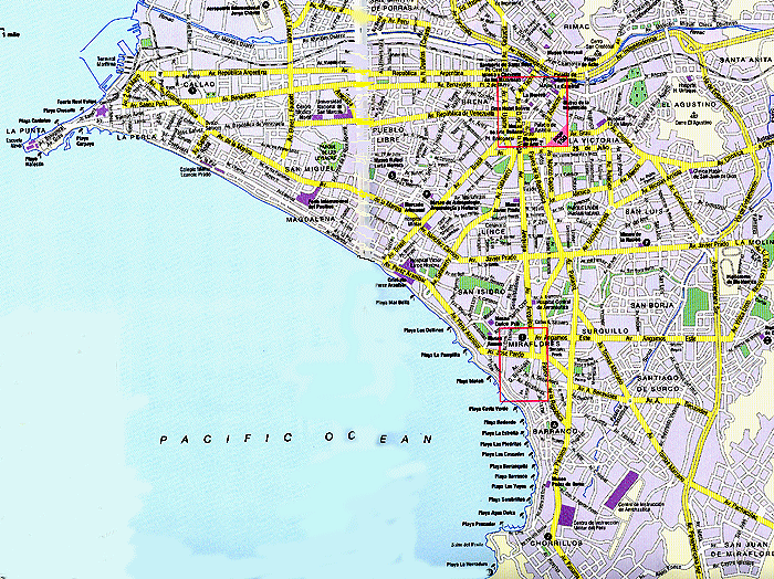
Map of Lima |
|
|---|
Source: Insight Guides: Peru, pp. 146-147. Comments: The port of Callao is to the upper left. The airport is along the map's edge at the upper left. Lima's Rímac River (for which Lima was named) is a thin blue line that parallels the top horizontal edge of the map. The historical center is marked in red in the upper center. At the lower center you see a neighborhood marked in red, Miraflores. This is the upper middle class neighborhood. |
|---|
|
 |
 |