Source: Gran Guía Turística, Ciudad de México. Mexico: El País Aguilar, 2003, pp. 120-121.
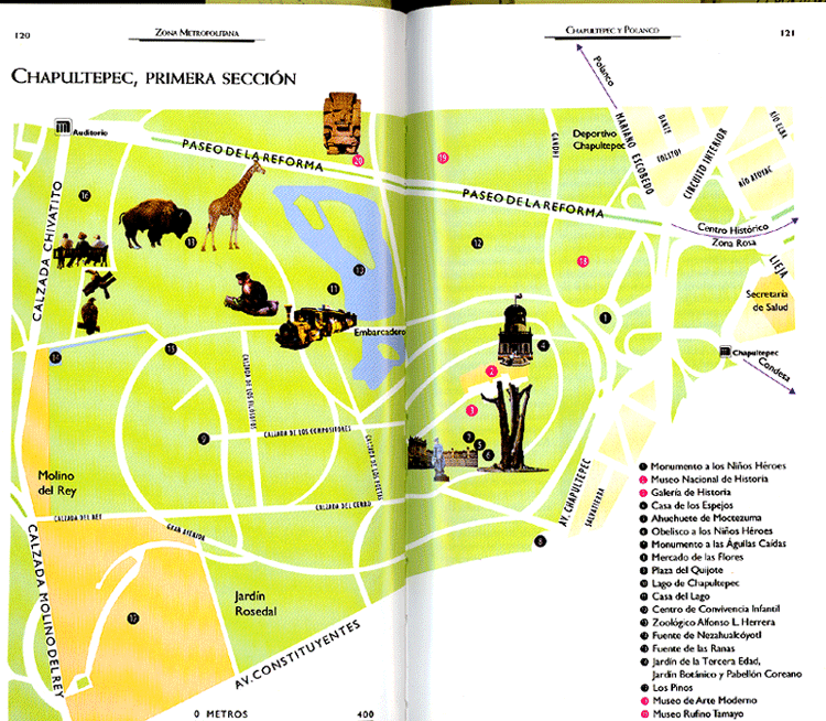
Comments: As we look at this map let us remember that we saw Chapultepec earlier. The place where you see the bare tree (Ahuehuete de Moctezuma) and the tower-like building (Casa de los Espejos) on the right-hand page is the same hill shown on the left side of the map of Lake Texcoco, which we look at when we studied Hernán Cortés and the conquest of Tenochtitlán. To orient ourselves, the great shaded area in the middle is Chapultepec, the largest public park in the city. To the north is the Polanco neighborhood (fraccionamiento), which is an upper middle-class area full of international boutiques, restaurants, jewelery stores, art galeries, and the like. Just off this map is the once glamorous, but still famous and nice international-style neighborhood called the Zona Rosa (pink zone). The red dots on the top (north) side of the park indicate three of Mexico's most important museums: the Museo Nacional de Antropología, the Museo de Arte Moderno, and the Museo de Arte Rufino Tamayo. To the upper left is the zoo, and the grand boulevard of Mexico City, the Paseo de la Reforma cuts through the park; to the right (east) it heads toward the city's historical core.