Source: WTL course files
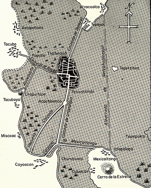
Map: The checkered medium dark shaded area is Lake Texcoco. The darkest are in the lake is Tenochtitlán. Things to notice: (1) the causeways (
calzadas) linking then mainland to the island; (2) the square in the center of the main island, which is the area of the Great Pyramid; (3) just to the north of the Great Pyramid is another, smaller, square: this is the important
Plaza de Tlatelolco; (4) at the north end of the Calzada de Tepeyac is the village of Tepeyac, important for the
Virgen de Guadalupe miracle story; (5) at the end of Calzada de Tacuba and the Acueducto is the hill of Chapultepec, which is where Moctezuma's palace was, where
la Malinche/Doña Marina lived; and where the Parque de Chapultepec and the Museo Nacional de Antropología are nowadays; and (6) at the bottom left, where the Calzada de Mexicaltzingo starts, is Coyaocán, which is the modern suburb of Mexico City where Frida Kahlo lived.