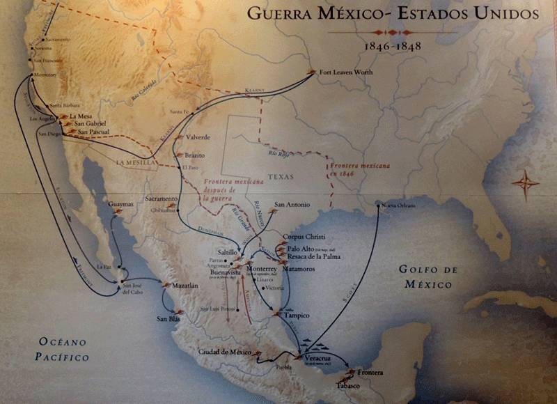
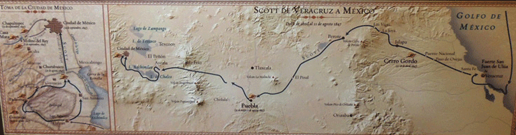
Source: Photographs by WTL© (2016) on site at the Museo de las Intervenciones, Coyoacán, México.
Images: Two maps showing the invasion routes by the United States Army into Mexican territory during the Mexican-American War (1846 - 1848). The top map show the multiple American invasion routes including Gen. Scott's invasion from New Orleans to Veracruz, Kearny's route from Fort Leavenworth to Los Angeles, and John C. Frémont's route of conquest from Monterey (Alta California) to Cabo San Lucas (Baja California). The bottom map shows Gen. Scott's route from Veracruz to Mexico City (he nearly followed Cortés's route) including the Battle of Churubusco (notice the inset map on the left in the bottom map), where this museum is now located.
Comments: Texas won its independence from Mexico in 1836 as the Lone Star Republic of Texas, and was admitted to the U.S. in 1845 as the 28th state (Florida was admitted earlier the same year as the 27th state). The United States then invaded Mexico in 1846. By the Treaty of Guadalupe Hidalgo, the United States acquired the entire Mexican northwest, which eventually became the states of California, Arizona, Nevada, Utah, New Mexico, and part of Colorado.