Tikal (1) |
|
|---|
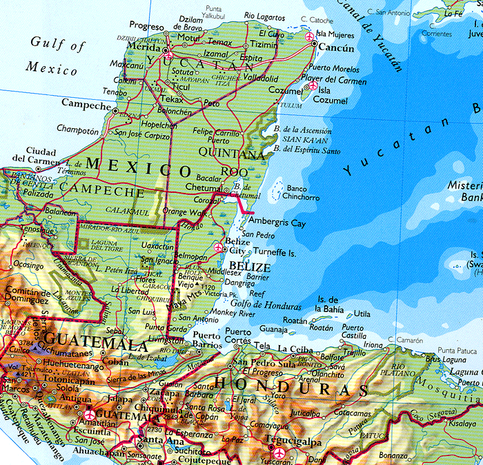
Source: Map of part of Central America focusing on the heart of the Mayas. Comments: The idea of this map is to show the relationship between Mayan lands (most of Guatemala, western Honduras and western El Salvador, almost all of Belize, and the Yucatán peninsula of México. In the middle of northern Guatemala, you see Lake Petén Itzá (small blue shading). Just above the lake (actually 68 km north) is Tikal. And farther to the N of Tikal near the border with Mexico is the major Mayan archeological site of El Mirador, potentially the largest of all Mayan city states with, possibly, the largest of all Mayan pyramids. This is the vast region known as the Maya Biosphere Reserve, the largest nominally protected area in Central America. For comments on the current ecological, social, demographic, and political situation of the entire, see: => Petén Itzá. In addition, in the far upper right, you see the far western tip of Cuba. It is curious to note that, as far as is known, there was virtually no cultural relationship between the Mayas and the Caribs and other pre-contact inhabitants of Cuba. |
|---|
|
 |
 |
 |