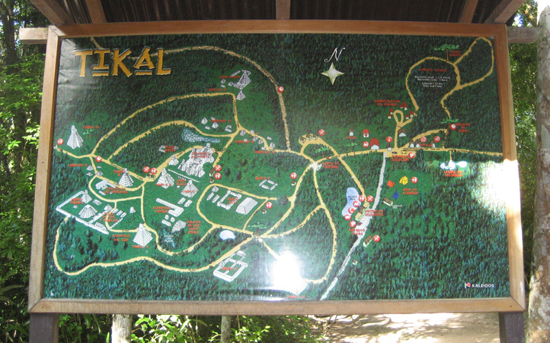
Source: WTL© digital photograph taken on site at Tikal (2008).
Comments: One sees this orientation sign at the main entrance to the Tikal archeological site. Bear in mind that what you see here represents most of what has been uncovered, and what is uncovered, some of which is partially restored, is perhaps one-tenth of what, at its peak, was the city-state of Tikal. Furthermore, as you will see in the digital tour that follows, Tikal was once a city that was not hidden in the forest. On the contrary, after the site was abandoned in the tenth century, the jungle covered the entire area, pyramids and all, for the next thousand years.
Schematic map: As you follow the chronological images and commentary in this show, it will be useful to refer to the following embedded map (
=> Tikal #2a) because it will enable you to draw your own right angle triangles that the Tikal's cosmologists, lords, priests, architects, and urban designers used to construct the buildings in their grand and great city-state.