San Agustín (1a) |
|
|---|
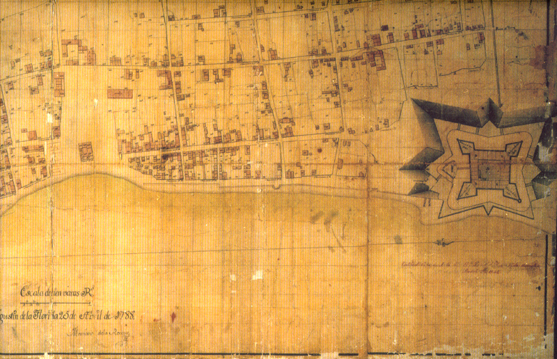
Source: This is a copy of a Spanish map of San Agustín drawn by Mariano de la Rocque on April 25, 1788 in the second Spanish period. He was a French engineer, and it is believed by scholars that it was commissioned by the Spanish Colonial Governor. It is titled "Plano particular de la Ciudad de San Agustín de la Florida..." (Detailed city map of Saint Augustine, Florida). Comments: A legend accompanying this map detailed lot sizes, construction materials, the kind of roof and the number of stories for each building in the city. In fact, when restoration of colonial Spanish San Agustín began in 1960, this map was used to certify the accuracy of the restoration projects. Humanities Questions: What is the name of the colonial period specific to Florida during which this map was created? Given the information that accompanied this map, what purpose do you think this map served? Additional: For a current tourist map of this northern end of Old St. Augustine, see: => San Agustín #1b. For a modern drawing of the Castillo de San Marcos, see: => San Agustín #1c. |
|---|
|
 |
 |
 |