Fort Mose (1) |
|
|---|
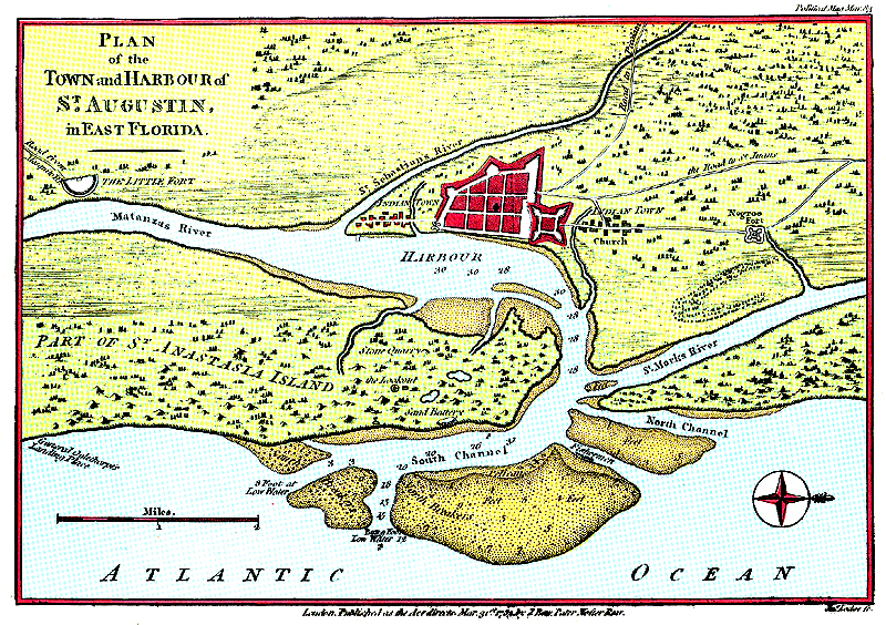
Source: P.K. Yonge Library of Florida History, George A. Smathers Libraries, University of Florida. Image: 1762 English map of the St. Augustine region. The "Indian town" is just to the right (north) of the Castillo de San Marcos, and Fort Mose ("Negroe Fort" on the map) is farther (2 miles) to the right (north). There is also an "Indian town" just to the left (south) of the town of "St. Augustin" (sic). Note that the town is shown as walled; the wall was added after its destruction by Carolinians in 1702. Comment and question: This map is by Thomas Jeffreys. What Anglocentric aspects do you see in this map? |
|---|
|
 |
 |
 |