Notes on Teotihuacan
100 BCE – 750 CE
 |
|---|
I. 100 BCE — 750 (Common Era)
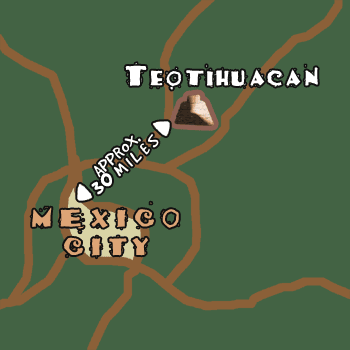
Following the Olmecs, the next major civilization of the pre-Columbian era that we shall take a brief notice of is Teotihuacan (pronounced either with stress on the last syllable, as in Teoitihuacán (traditional) or next-to-last syllable, as in Teotihuacan (contemporary or indigenous pronunciation). As you can see on the image above, the archeological zone of Teotihuacan is about 30 miles north of Mexico City. It is found in the Valle de Teotihuacan, which measures about 9 miles by 4 miles. In the center was a large city covering about one mile square. Apparently, the teotihuacanos originated at Cuicuilco on the south side of Lake Texcoco (south Mexico City and just south of the Valle de Anáhuac, the center of which is where Mexico City is situated). The people of Cuicuilco worshipped the fire god Huehuetéotl in the volcanic peak of Xitla, which was southwest of Cuicuilco. When Xilta erupted lava flowed first north to Lake Texcoco, and then it circled back south to Cuicuilco, where it encircled the pyramid dedicated to Huehuetéotl. The Cuicuilco people abandonded the site and migrated north to the Valley of Teotihuacan, which is at the extreme north end of the central valley of Anáhuac.
II. Cuicuilco
For images and a brief description of the archeological site of Cuicuilco, in the southern suburbs of Mexico City, click on the following image:
 |
|---|
III. Teotihuacan I
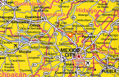 |
| This portion of the map of México (from my Frommer's map) shows the region of SFCC's Mexico trip in 2008: Mexico City, Guanajuato (upper left), San Miguel de Allende (upper left central), Querétaro (below San Miguel de Allende). It also shows Teotihuacan just north of Mexico City. And just north of Teotihuacan you see what this map calls "The Giants of Tula", 75 km north of Mexico City. |
IV. Teotihuacan II
 |
 |
|---|---|
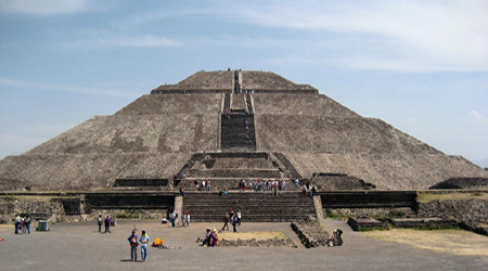
This is a photo of the Pyramid of the Sun (la pirámide del sol). |
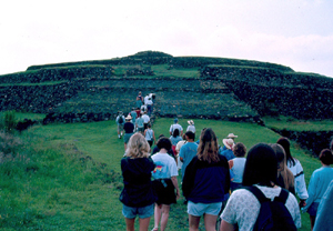
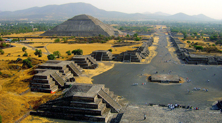
Here is a view of view of Teotihuacan looking south down the "Street of the Dead" toward the Pyramid of the Moon and beyond to the south of the small Valle de Teotihuacan. |
|
 |