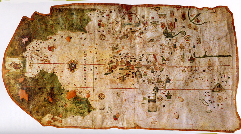
Source:WTL© photo from his personal poster of Juan de la Cosa's 1500 map. Original in the Naval Museum (Museo Naval), Madrid.
Notes: The clump of small images in the middle of this map is placed over West Africa. Spain is right above this clump of images, and the rest of Europe is toward the top middle. Asia is to the right. As you can see (vaguely) the details of Africa, Europe, and some of the Arab lands in the Middle East were well known, but Asia remained largely speculation. To the bottom left (southwest) is what was known of South America. The Caribbean is at left center, and North America (NW) is top left. The outline of Cuba is visible and is fairly accurate. With Columbus's first three of his four voyages, as you see on this portolan or mappa mundi, the first details of the Caribbean and the north coast of South America had begun to take preliminary concrete shape.
Embedded views: For more views of this major treasure of Latin American and world humanities artifacts, see: => Juan de la Cosa details.
Questions: Can you see where Florida is hinted at? What is the image at the far middle left? Toward what cardinal point is this map oriented? (This is a fascinating problem concerning a shift in geographical thinking among Spanish mariners, cartographers, geographers, incipient scientists, and humanists at the turn of the 16th century.)